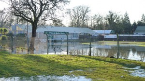
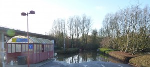
This week the flooding started on Christmas day and the police closed many of the key roads, instigating a volley of frantic e-mails and phone calls from people trying to find their way around the closed off areas, such as Loddon Bridge roundabout and the route between Shinfield and Arborfield. I guess in some ways we were all lucky it wasn’t a busy work day, but I suspect that everyone’s memory is too short on what happens on those days.
Living close to both the Emmbrook and the Loddon rivers, every time it rains for more than a couple of days, I start wondering what is going to flood? What roads will be blocked, will I be able to get to work, is my car safe? I can also see that for some local residents, their thoughts are is my house safe, will I need to move my furniture or my family etc?
Many of the businesses and homes in the area are well prepared for the occasionally flood and have learned to live with the inconvenience. My main fear is that the demand for housing & development is so strong that we continue to build near the areas that flood, with only the minimal thought about where the water is to go and the wider effect.
The Environment Agency tells the developers that it will be OK and they decide that there is an acceptable risk, even though anyone who has lived here for any length of time, knows that these areas are prone to flooding. Never mind the fact that f we push the water away from the new developments and cover the areas that act as a big sponge, it then pushes the water into areas that have not flooded before.
Perhaps we should look at a different ideas for these areas, such as building houses on stilts, not concreting off the driveways and streets? Or how about returning some of the concreted areas back to a more natural state. Answers on a postcard please…..


